Mixwell LibraryPlan an oil painting with Leonardo as your teacherTry Mixwell free

Mixwell Library › Leonardo da Vinci › The Notebooks › Part XVII

Part XVII. Topographical Notes

The Notebooks of Leonardo da Vinci · translated by Jean Paul Richter · § 1001 to 1112 · 8 plates · public domain · plain text

Richter’s introduction to this part

A large part of the texts published in this section might perhaps have found their proper place in connection with the foregoing chapters on Physical Geography. But these observations on Physical Geography, of whatever kind they may be, as soon as they are localised acquire a special interest and importance and particularly as bearing on the question whether Leonardo himself made the observations recorded at the places mentioned or merely noted the statements from hearsay. In a few instances he himself tells us that he writes at second hand. In some cases again, although the style and expressions used make it seem highly probable that he has derived his information from others— though, as it seems to me, these cases are not very numerous—we find, on the other hand, among these topographical notes a great number of observations, about which it is extremely difficult to form a decided opinion. Of what the Master's life and travels may have been throughout his sixty-seven years of life we know comparatively little; for a long course of time, and particularly from about 1482 to 1486, we do not even know with certainty that he was living in Italy. Thus, from a biographical point of view a very great interest attaches to some of the topographical notes, and for this reason it seemed that it would add to their value to arrange them in a group by themselves. Leonardo's intimate knowledge with places, some of which were certainly remote from his native home, are of importance as contributing to decide the still open question as to the extent of Leonardo's travels. We shall find in these notes a confirmation of the view, that the MSS. in which the Topographical Notes occur are in only a very few instances such diaries as may have been in use during a journey. These notes are mostly found in the MSS. books of his later and quieter years, and it is certainly remarkable that Leonardo is very reticent as to the authorities from whom he quotes his facts and observations: For instance, as to the Straits of Gibraltar, the Nile, the Taurus Mountains and the Tigris and Euphrates. Is it likely that he, who declared that in all scientific research, his own experience should be the foundation of his statements (see XIX Philosophy No. 987–991,) should here have made an exception to this rule without mentioning it?

As for instance in the discussion as to the equilibrium of the mass of water in the Mediterranean Sea—a subject which, it may be observed, had at that time attracted the interest and study of hardly any other observer. The acute remarks, in Nos. 985–993, on the presence of shells at the tops of mountains, suffice to prove—as it seems to me—that it was not in his nature to allow himself to be betrayed into wide generalisations, extending beyond the limits of his own investigations, even by such brilliant results of personal study.

Most of these Topographical Notes, though suggesting very careful and thorough research, do not however, as has been said, afford necessarily indisputable evidence that that research was Leonardo's own. But it must be granted that in more than one instance probability is in favour of this idea.

Among the passages which treat somewhat fully of the topography of Eastern places by far the most interesting is a description of the Taurus Mountains; but as this text is written in the style of a formal report and, in the original, is associated with certain letters which give us the history of its origin, I have thought it best not to sever it from that connection. It will be found under No. XXI (Letters).

That Florence, and its neighbourhood, where Leonardo spent his early years, should be nowhere mentioned except in connection with the projects for canals, which occupied his attention for some short time during the first ten years of the XVIth century, need not surprise us. The various passages relating to the construction of canals in Tuscany, which are put together at the beginning, are immediately followed by those which deal with schemes for canals in Lombardy; and after these come notes on the city and vicinity of Milan as well as on the lakes of North Italy.

The notes on some towns of Central Italy which Leonardo visited in 1502, when in the service of Cesare Borgia, are reproduced here in the same order as in the note book used during these travels (MS. L., Institut de France). These notes have but little interest in themselves excepting as suggesting his itinerary. The maps of the districts drawn by Leonardo at the time are more valuable (see No. 1054 note). The names on these maps are not written from right to left, but in the usual manner, and we are permitted to infer that they were made in obedience to some command, possibly for the use of Cesare Borgia himself; the fact that they remained nevertheless in Leonardo's hands is not surprising when we remember the sudden political changes and warlike events of the period. There can be no doubt that these maps, which are here published for the first time, are original in the strictest sense of the word, that is to say drawn from observations of the places themselves; this is proved by the fact—among others—that we find among his manuscripts not only the finished maps themselves but the rough sketches and studies for them. And it would perhaps be difficult to point out among the abundant contributions to geographical knowledge published during the XVIth century, any maps at all approaching these in accuracy and finish.

The interesting map of the world, so far as it was then known, which is among the Leonardo MSS. at Windsor (published in the 'Archaeologia' Vol. XI) cannot be attributed to the Master, as the Marchese Girolamo d'Adda has sufficiently proved; it has not therefore been reproduced here.

Such of Leonardo's observations on places in Italy as were made before or after his official travels as military engineer to Cesare Borgia, have been arranged in alphabetical order, under Nos. 1034-1054. The most interesting are those which relate to the Alps and the Appenines, Nos. 1057-1068.

Most of the passages in which France is mentioned have hitherto remained unknown, as well as those which treat of the countries bordering on the Mediterranean, which come at the end of this section. Though these may be regarded as of a more questionable importance in their bearing on the biography of the Master than those which mention places in France, it must be allowed that they are interesting as showing the prominent place which the countries of the East held in his geographical studies. He never once alludes to the discovery of America.
I. Italy

Canals in connection with the Arno (1001-1008)

§ 1001

Canal of Florence

Sluices should be made in the valley of la Chiana at Arezzo, so that when, in the summer, the Arno lacks water, the canal may not remain dry: and let this canal be 20 braccia wide at the bottom, and at the top 30, and 2 braccia deep, or 4, so that two of these braccia may flow to the mills and the meadows, which will benefit the country; and Prato, Pistoia and Pisa, as well as Florence, will gain two hundred thousand ducats a year, and will lend a hand and money to this useful work; and the Lucchese the same, for the lake of Sesto will be navigable; I shall direct it to Prato and Pistoia, and cut through Serravalle and make an issue into the lake; for there will be no need of locks or supports, which are not lasting and so will always be giving trouble in working at them and keeping them up.

And know that in digging this canal where it is 4 braccia deep, it will cost 4 dinari the square braccio; for twice the depth 6 dinari, if you are making 4 braccia and there are but 2 banks; that is to say one from the bottom of the trench to the surface of the edges of it, and the other from these edges to the top of the ridge of earth which will be raised on the margin of the bank. And if this bank were of double the depth only the first bank will be increased, that is 4 braccia increased by half the first cost; that is to say that if at first 4 dinari were paid for 2 banks, for 3 it would come to 6, at 2 dinari the bank, if the trench measured 16 braccia at the bottom; again, if the trench were 16 braccia wide and 4 deep, coming to 4 lire for the work, 4 Milan dinari the square braccio; a trench which was 32 braccia at the bottom would come to 8 dinari the square braccio.

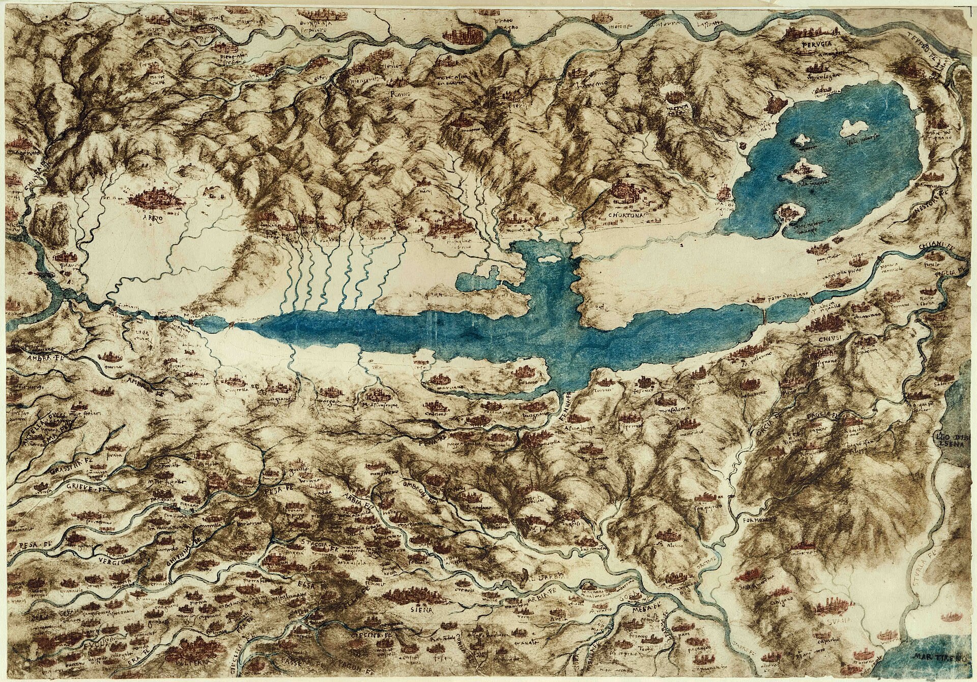
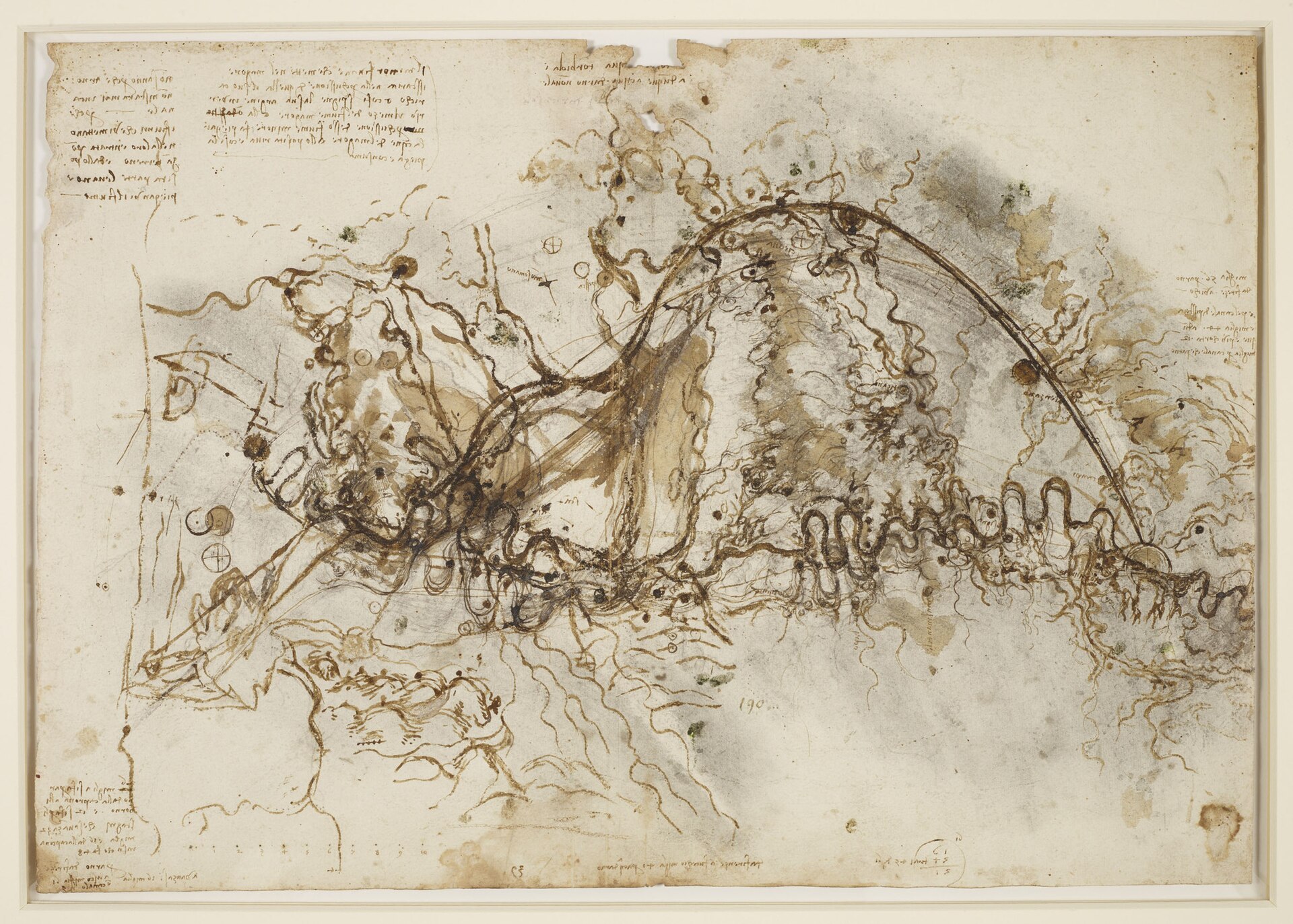
Leonardo, A map of the Valdichiana, Royal Collection, RCIN 912278
Leonardo, A map of the Valdichiana, Royal Collection, RCIN 912278 Source

C. A. 45a; 140a

§ 1002

>From the wall of the Arno at [the gate of] la Giustizia to the bank of the Arno at Sardigna where the walls are, to the mills, is 7400 braccia, that is 2 miles and 1400 braccia and beyond the Arno is 5500 braccia.

L. 1a

§ 1003

By guiding the Arno above and below a treasure will be found in each acre of ground by whomsoever will.

Leonardo, A scheme for a canal to bypass the Arno, Royal Collection, RCIN 912279
Leonardo, A scheme for a canal to bypass the Arno, Royal Collection, RCIN 912279 Source

C. A. 284a; 865a

§ 1004

The wall of the old houses runs towards the gate of San Nicolo.

Br. M. 273b · MS. W. L. 2

§ 1005

The ruined wall is 640 braccia; 130 is the wall remaining with the mill; 300 braccia were broken in 4 years by Bisarno.

Br. M. 274a

§ 1006

They do not know why the Arno will never remain in a channel. It is because the rivers which flow into it deposit earth where they enter, and wear it away on the opposite side, bending the river in that direction. The Arno flows for 6 miles between la Caprona and Leghorn; and for 12 through the marshes, which extend 32 miles, and 16 from La Caprona up the river, which makes 48; by the Arno from Florence beyond 16 miles; to Vico 16 miles, and the canal is 5; from Florence to Fucechio it is 40 miles by the river Arno.

56 miles by the Arno from Florence to Vico; by the Pistoia canal it is 44 miles. Thus it is 12 miles shorter by the canal than by the Arno.

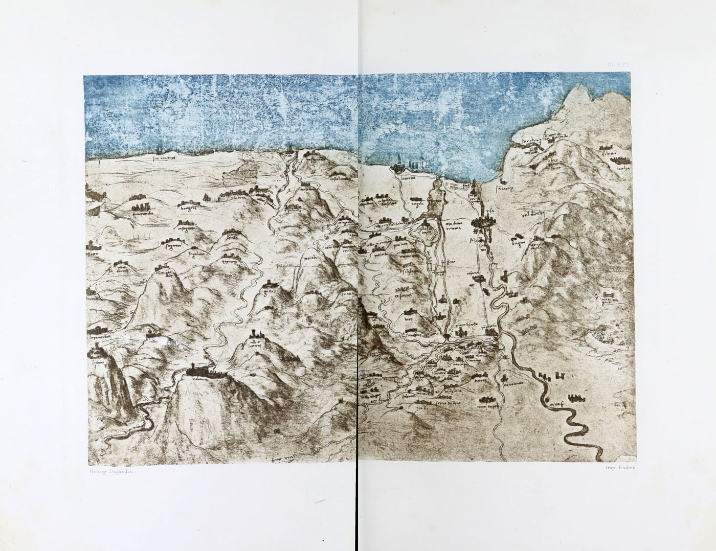
Plate CXII: Coloured Map of part of Tuscany, from the Royal Library, Windsor Castle
Plate CXII. Coloured Map of part of Tuscany, from the Royal Library, Windsor Castle

W. L. 226a · Pl. CXII

§ 1007

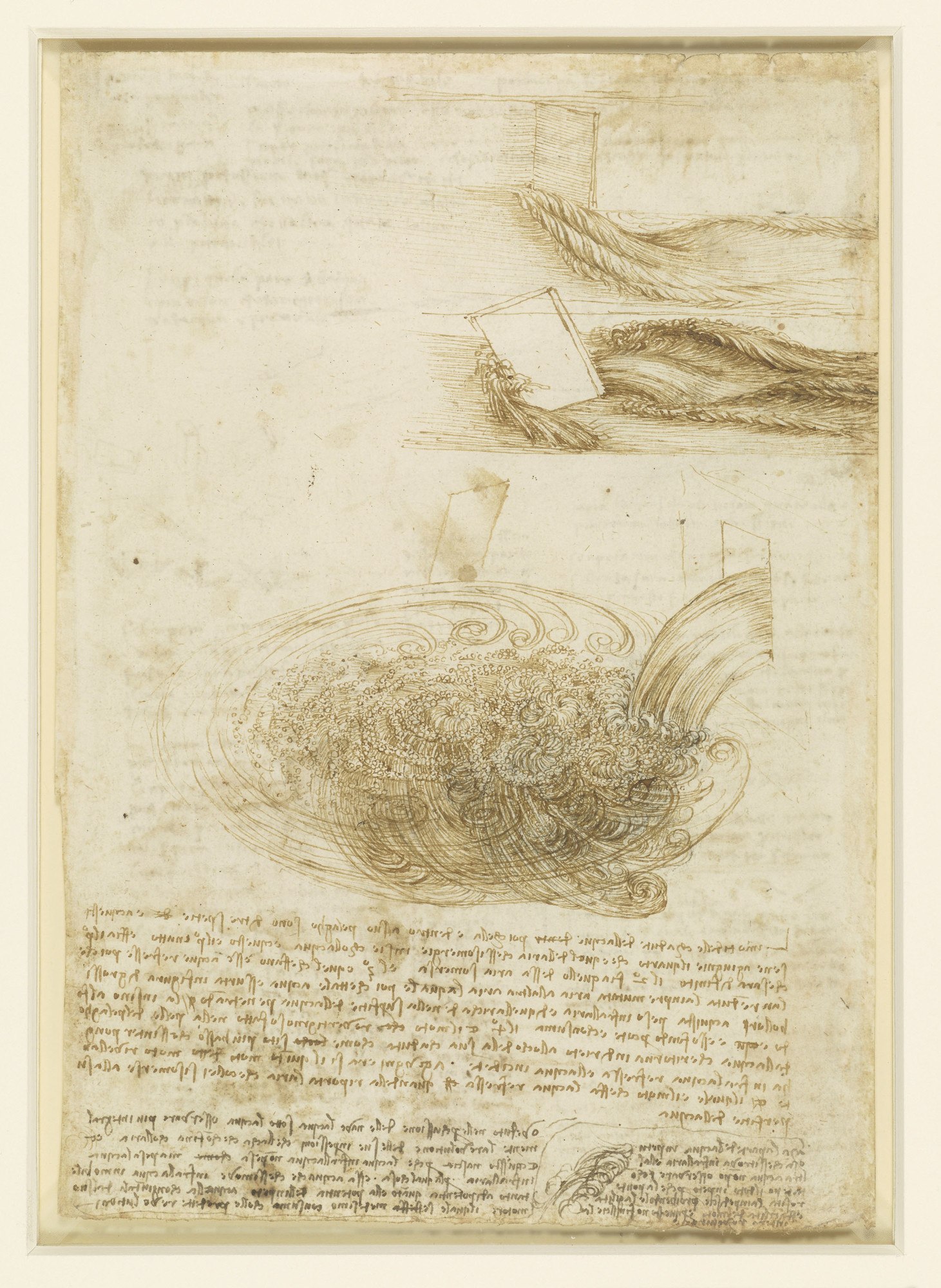
The eddy made by the Mensola, when the Arno is low and the Mensola full.

Leonardo, Studies of water falling into a pool, with notes (verso of studies of water), Royal Collection, RCIN 912660 verso
Leonardo, Studies of water falling into a pool, with notes (verso of studies of water), Royal Collection, RCIN 912660 verso Source

Leic. 18b

§ 1008

That the river which is to be turned from one place to another must be coaxed and not treated roughly or with violence; and to do this a sort of floodgate should be made in the river, and then lower down one in front of it and in like manner a third, fourth and fifth, so that the river may discharge itself into the channel given to it, or that by this means it may be diverted from the place it has damaged, as was done in Flanders—as I was told by Niccolo di Forsore.

How to protect and repair the banks washed by the water, as below the island of Cocomeri.

Ponte Rubaconte (Fig. 1); below [the palaces] Bisticci and Canigiani (Fig. 2). Above the flood gate of la Giustizia (Fig. 3); a b is a sand bank opposite the end of the island of the Cocomeri in the middle of the Arno (Fig. 4).

Leic. 13a

Canals in the Milanese (1009-1013)

§ 1009

The canal of San Cristofano at Milan made May 3rd 1509.

C. A. 387a; 1197a

§ 1010

Of the Canal of Martesana

By making the canal of Martesana the water of the Adda is greatly diminished by its distribution over many districts for the irrigation of the fields. A remedy for this would be to make several little channels, since the water drunk up by the earth is of no more use to any one, nor mischief neither, because it is taken from no one; and by making these channels the water which before was lost returns again and is once more serviceable and useful to men.

F. 76b · MS. H2 17a

§ 1011

No canal which is fed by a river can be permanent if the river whence it originates is not wholly closed up, like the canal of Martesana which is fed by the Ticino.

Leic. 18a

§ 1012

>From the beginning of the canal to the mill.

>From the beginning of the canal of Brivio to the mill of Travaglia is 2794 trabochi, that is 11176 braccia, which is more than 3 miles and two thirds; and here the canal is 57 braccia higher than the surface of the water of the Adda, giving a fall of two inches in every hundred trabochi; and at that spot we propose to take the opening of our canal.

C. A. 139b; 421b

§ 1013

If it be not reported there that this is to be a public canal, it will be necessary to pay for the land; and the king will pay it by remitting the taxes for a year.

C. A. 233a; 700a

Estimates and preparatory studies for canals (1014. 1015)

§ 1014

Canal

The canal which may be 16 braccia wide at the bottom and 20 at the top, we may say is on the average 18 braccia wide, and if it is 4 braccia deep, at 4 dinari the square braccia; it will only cost 900 ducats, to excavate by the mile, if the square braccio is calculated in ordinary braccia; but if the braccia are those used in measuring land, of which every 4 are equal to 4 1/2 and if by the mile we understand three thousand ordinary braccia; turned into land braccia, these 3000 braccia will lack 1/4; there remain 2250 braccia, which at 4 dinari the braccio will amount to 675 ducats a mile. At 3 dinari the square braccio, the mile will amount to 506 1/4 ducats so that the excavation of 30 miles of the canal will amount to 15187 1/2 ducats.

H.2 43a

§ 1015

To make the great canal, first make the smaller one and conduct into it the waters which by a wheel will help to fill the great one.

Br. M. 149a

Notes on buildings in Milan (1016-1019)

§ 1016

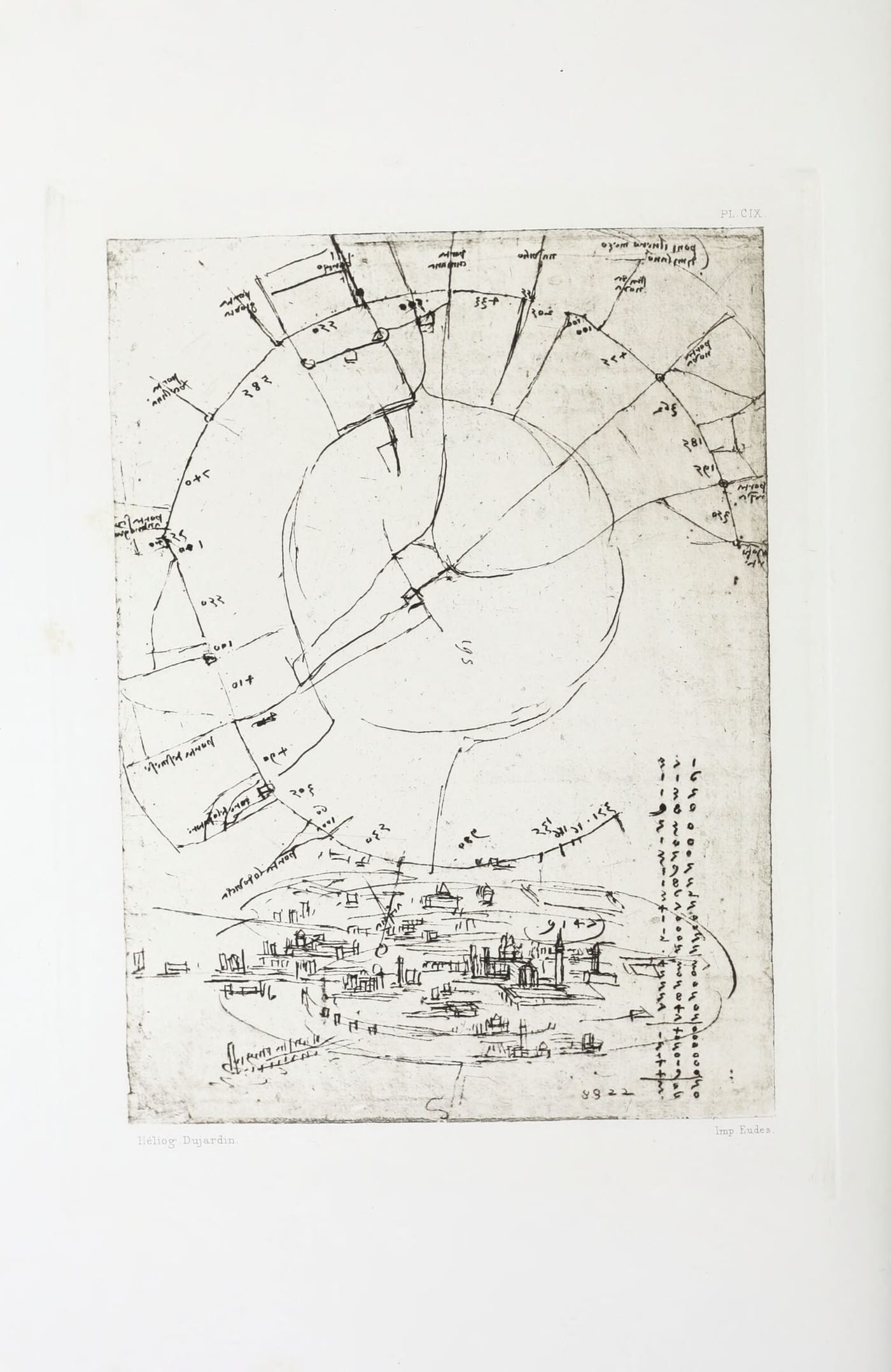
Indicate the centre of Milan.

Moforte—porta resa—porta nova—strada nova—navilio—porta cumana—barco—porta giovia—porta vercellina—porta sco Anbrogio—porta Tesinese—torre dell' Imperatore— porta Lodovica—acqua.

Plate CIX: Sketch Map of Milan; from the Codex Atlanticus, Milan—see text No. 1016
Plate CIX. Sketch Map of Milan; from the Codex Atlanticus, Milan—see text No. 1016

C. A. 72b; 211b · Pl. CIX

§ 1017

The moat of Milan.

Canal 2 braccia wide.

The castle with the moats full.

The filling of the moats of the Castle of Milan.

I.1 32b

§ 1018

The Bath

To heat the water for the stove of the Duchess take four parts of cold water to three parts of hot water.

I.1 34a

§ 1019

In the Cathedral at the pulley of the nail of the cross.

Item.

To place the mass v r in the...

L. 15a

§ 1020

Of the Force of the Vacuum Formed in a Moment

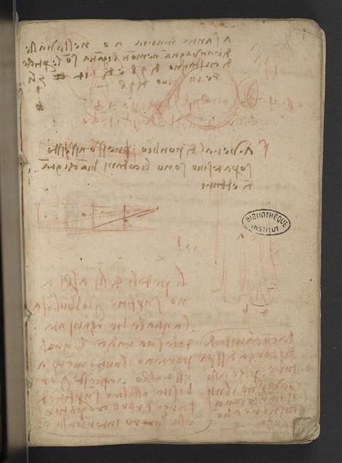
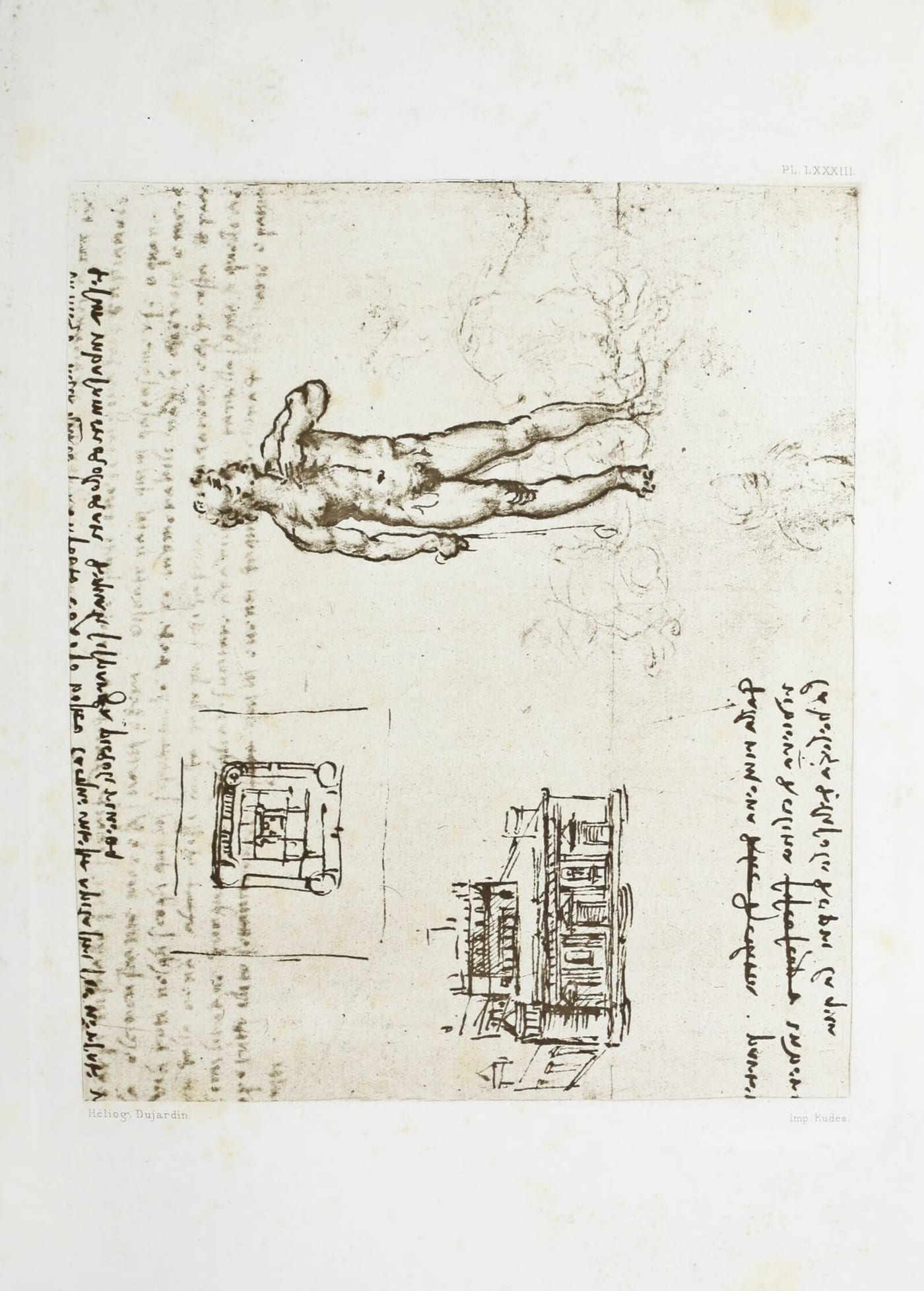
I saw, at Milan, a thunderbolt fall on the tower della Credenza on its Northern side, and it descended with a slow motion down that side, and then at once parted from that tower and carried with it and tore away from that wall a space of 3 braccia wide and two deep; and this wall was 4 braccia thick and was built of thin and small old bricks; and this was dragged out by the vacuum which the flame of the thunderbolt had caused, &c.

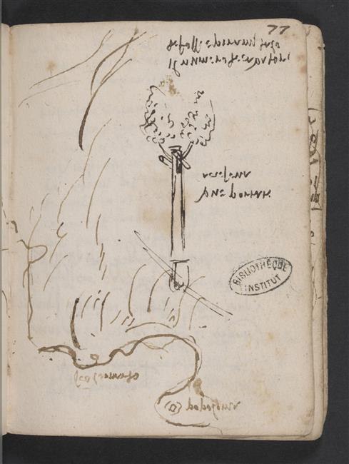
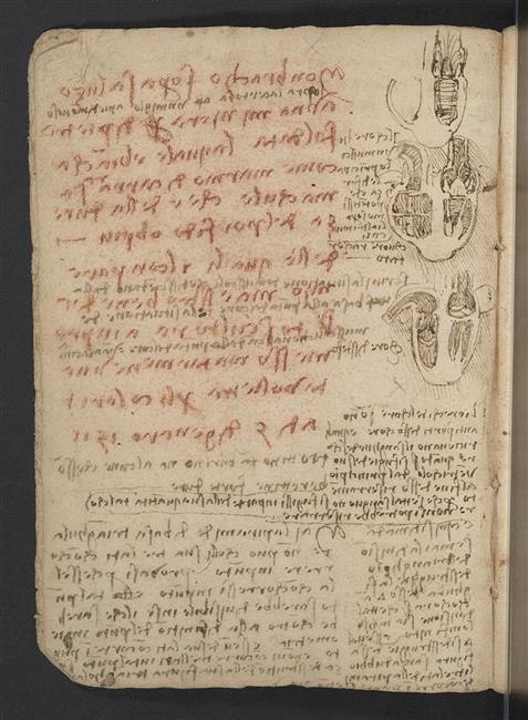
Manuscript page cited by Richter for this passage: Leonardo, Paris Manuscript E, f. 1r, Bibliothèque de l'Institut de France
Manuscript page cited by Richter for this passage: Leonardo, Paris Manuscript E, f. 1r, Bibliothèque de l'Institut de France Source

E. 1a · Pl. XCV, No. 2 · Pl. C

Compare Plate XCV, shown with § 757

Compare Plate C, shown with § 758

Remarks on natural phenomena in and near Milan (1021. 1022)

§ 1021

I have already been to see a great variety (of atmospheric effects). And lately over Milan towards Lago Maggiore I saw a cloud in the form of an immense mountain full of rifts of glowing light, because the rays of the sun, which was already close to the horizon and red, tinged the cloud with its own hue. And this cloud attracted to it all the little clouds that were near while the large one did not move from its place; thus it retained on its summit the reflection of the sunlight till an hour and a half after sunset, so immensely large was it; and about two hours after sunset such a violent wind arose, that it was really tremendous and unheard of.

Leic. 28a

§ 1022

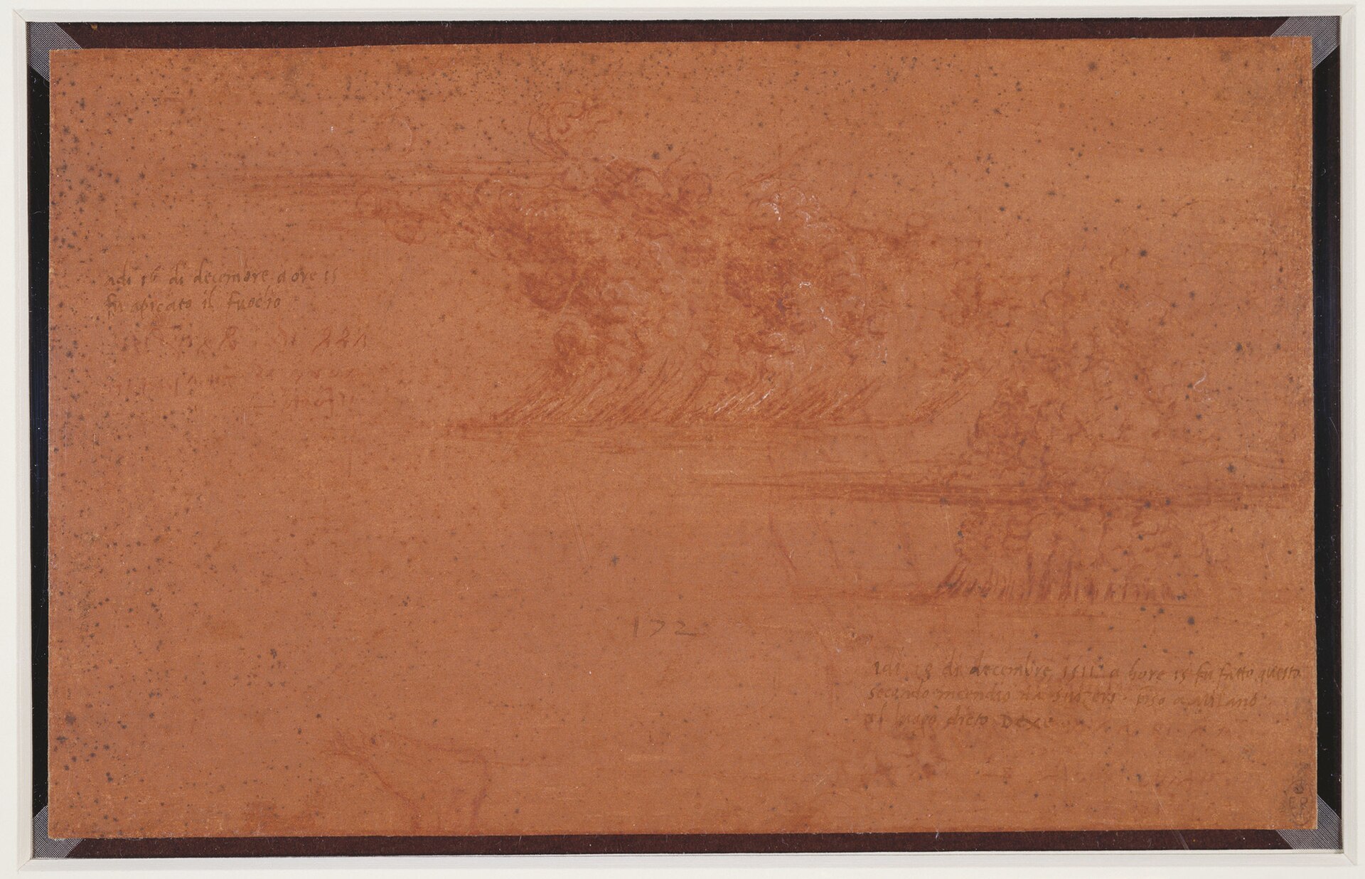
On the 10th day of December at 9 o'clock a. m. fire was set to the place.

On the l8th day of December 1511 at 9 o'clock a. m. this second fire was kindled by the Swiss at Milan at the place called DCXC.

Leonardo, Two fires set by the Swiss army outside Milan, with notes; and a foot, Royal Collection, RCIN 912416
Leonardo, Two fires set by the Swiss army outside Milan, with notes; and a foot, Royal Collection, RCIN 912416 Source

W. XXVIII

Note on Pavia

§ 1023

The chimneys of the castle of Pavia have 6 rows of openings and from each to the other is one braccio.

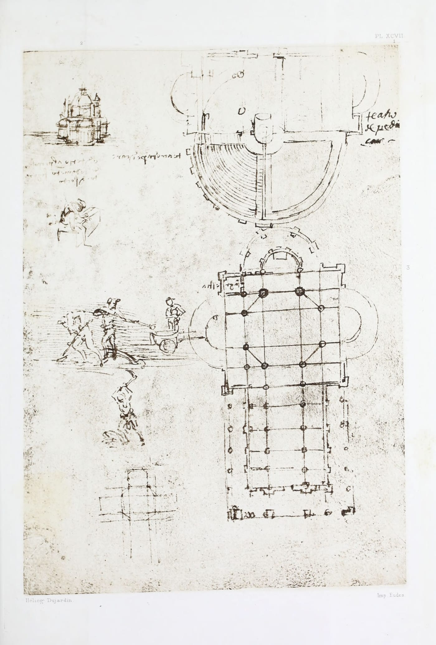
Plate XCVII: Drawing of Churches; from Manuscript B, Institut de France, Paris
Plate XCVII. Drawing of Churches; from Manuscript B, Institut de France, Paris

B. 58a · Pl. XCVIII, No. 3

Notes on the Sforzesca near Vigevano (1024-1028)

§ 1024

On the 2nd day of February 1494. At Sforzesca I drew twenty five steps, 2/3 braccia to each, and 8 braccia wide.

H.2 17b · Pl. CX, No. 2

See Plate CX, shown with § 765

§ 1025

The vineyards of Vigevano on the 20th day of March 1494.

H.1 38a

§ 1026

To lock up a butteris at Vigevano.

H.1 1a

§ 1027

Again if the lowest part of the bank which lies across the current of the waters is made in deep and wide steps, after the manner of stairs, the waters which, in their course usually fall perpendicularly from the top of such a place to the bottom, and wear away the foundations of this bank can no longer descend with a blow of too great a force; and I find the example of this in the stairs down which the water falls in the fields at Sforzesca at Vigevano over which the running water falls for a height of 50 braccia.

Leic. 21a

§ 1028

Stair of Vigevano below La Sforzesca, 130 steps, 1/4 braccio high and 1/2 braccio wide, down which the water falls, so as not to wear away anything at the end of its fall; by these steps so much soil has come down that it has dried up a pool; that is to say it has filled it up and a pool of great depth has been turned into meadows.

Leic. 32a

Notes on the North Italian lake. (1029-1033)

§ 1029

In many places there are streams of water which swell for six hours and ebb for six hours; and I, for my part, have seen one above the lake of Como called Fonte Pliniana, which increases and ebbs, as I have said, in such a way as to turn the stones of two mills; and when it fails it falls so low that it is like looking at water in a deep pit.

Leic. 11b

§ 1030

Lake of Como. Valley of Chiavenna

Above the lake of Como towards Germany is the valley of Chiavenna where the river Mera flows into this lake. Here are barren and very high mountains, with huge rocks. Among these mountains are to be found the water-birds called gulls. Here grow fir trees, larches and pines. Deer, wildgoats, chamois, and terrible bears. It is impossible to climb them without using hands and feet. The peasants go there at the time of the snows with great snares to make the bears fall down these rocks. These mountains which very closely approach each other are parted by the river. They are to the right and left for the distance of 20 miles throughout of the same nature. >From mile to mile there are good inns. Above on the said river there are waterfalls of 400 braccia in height, which are fine to see; and there is good living at 4 soldi the reckoning. This river brings down a great deal of timber.

VAL SASINA.

Val Sasina runs down towards Italy; this is almost the same form and character. There grow here many mappello and there are great ruins and falls of water.

VALLEY OF INTROZZO.

This valley produces a great quantity of firs, pines and larches; and from here Ambrogio Fereri has his timber brought down; at the head of the Valtellina are the mountains of Bormio, terrible and always covered with snow; marmots (?) are found there.

BELLAGGIO.

Opposite the castle Bellaggio there is the river Latte, which falls from a height of more than 100 braccia from the source whence it springs, perpendicularly, into the lake with an inconceivable roar and noise. This spring flows only in August and September.

VALTELLINA.

Valtellina, as it is called, is a valley enclosed in high and terrible mountains; it produces much strong wine, and there is so much cattle that the natives conclude that more milk than wine grows there. This is the valley through which the Adda passes, which first runs more than 40 miles through Germany; this river breeds the fish temolo which live on silver, of which much is to be found in its sands. In this country every one can sell bread and wine, and the wine is worth at most one soldo the bottle and a pound of veal one soldo, and salt ten dinari and butter the same and their pound is 30 ounces, and eggs are one soldo the lot.

C. A. 211a; 619a

§ 1031

At BORMIO.

At Bormio are the baths;—About eight miles above Como is the Pliniana, which increases and ebbs every six hours, and its swell supplies water for two mills; and its ebbing makes the spring dry up; two miles higher up there is Nesso, a place where a river falls with great violence into a vast rift in the mountain. These excursions are to be made in the month of May. And the largest bare rocks that are to be found in this part of the country are the mountains of Mandello near to those of Lecco, and of Gravidona towards Bellinzona, 30 miles from Lecco, and those of the valley of Chiavenna; but the greatest of all is that of Mandello, which has at its base an opening towards the lake, which goes down 200 steps, and there at all times is ice and wind.

IN VAL SASINA.

In Val Sasina, between Vimognio and Introbbio, to the right hand, going in by the road to Lecco, is the river Troggia which falls from a very high rock, and as it falls it goes underground and the river ends there. 3 miles farther we find the buildings of the mines of copper and silver near a place called Pra' Santo Pietro, and mines of iron and curious things. La Grigna is the highest mountain there is in this part, and it is quite bare.

C. A. 211b; 619b

§ 1032

The lake of Pusiano flows into the lake of Segrino and of Annone and of Sala. The lake of Annone is 22 braccia higher at the surface of its water than the surface of the water of the lake of Lecco, and the lake of Pusiano is 20 braccia higher than the lake of Annone, which added to the afore said 22 braccia make 42 braccia and this is the greatest height of the surface of the lake of Pusiano above the surface of the lake of Lecco.

C. A. 270a; 821a

§ 1033

At Santa Maria in the Valley of Ravagnate in the mountains of Brianza are the rods of chestnuts of 9 braccia and one out of an average of 100 will be 14 braccia.

At Varallo di Ponbia near to Sesto on the Ticino the quinces are white, large and hard.

Manuscript page cited by Richter for this passage: Leonardo, Paris Manuscript G, f. 1r, Bibliothèque de l'Institut de France
Manuscript page cited by Richter for this passage: Leonardo, Paris Manuscript G, f. 1r, Bibliothèque de l'Institut de France Source

G. 1a

Notes on places in Central Italy, visited in 1502 (1034-1054)

§ 1034

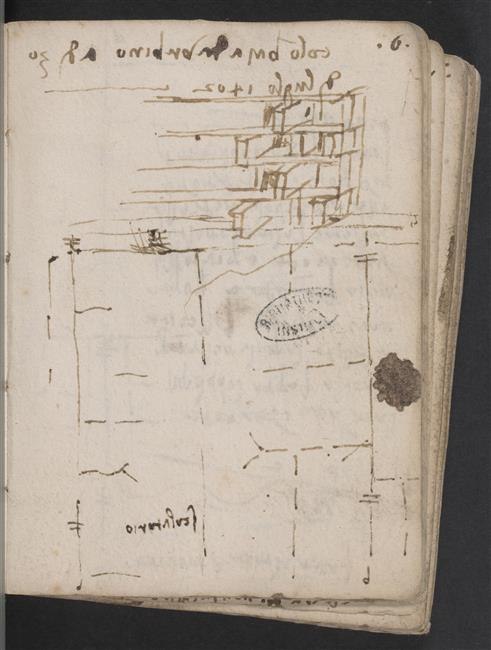
Pigeon-house at Urbino, the 30th day of July 1502.

Manuscript page cited by Richter for this passage: Leonardo, Paris Manuscript L, f. 6r, Bibliothèque de l'Institut de France
Manuscript page cited by Richter for this passage: Leonardo, Paris Manuscript L, f. 6r, Bibliothèque de l'Institut de France Source

L. 6a

§ 1035

Made by the sea at Piombino.

L. 6b

§ 1037

The rock of Cesena.

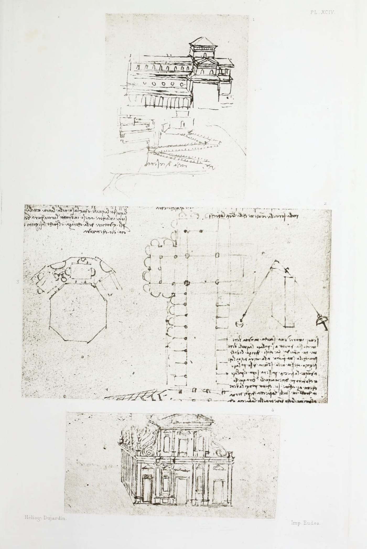
Plate XCIV: Three Drawings of Churches: No. 1 from Manuscript L, and Nos. 2 and 3 from Manuscript B, Institut de France, Paris; No. 34 [sic] from the Ambrosian Library, Milan
Plate XCIV. Three Drawings of Churches: No. 1 from Manuscript L, and Nos. 2 and 3 from Manuscript B, Institut de France, Paris; No. 34 [sic] from the Ambrosian Library, Milan

L. 15b · Pl. XCIV, No. 1

§ 1038

Siena, a b 4 braccia, a c 10 braccia. Steps at [the castle of] Urbino.

L. 19b · Pl. CX, No. 3

See Plate CX, shown with § 765

§ 1039

The bell of Siena, that is the manner of its movement, and the place of the attachment of the clapper.

L. 33b

§ 1040

On St. Mary's day in the middle of August, at Cesena, 1502.

L. 36b · Pl. CX, No. 4

See Plate CX, shown with § 765

§ 1041

Stairs of the [palace of the] Count of Urbino,—rough.

L. 40a

§ 1042

At the fair of San Lorenzo at Cesena. 1502.

L. 46b

§ 1044

At Porto Cesenatico, on the 6th of September 1502 at 9 o'clock a. m.

The way in which bastions ought to project beyond the walls of the towers to defend the outer talus; so that they may not be taken by artillery.

L. 66b

§ 1045

The rock of the harbour of Cesena is four points towards the South West from Cesena.

L. 67a

§ 1046

In Romagna, the realm of all stupidity, vehicles with four wheels are used, of which O the two in front are small and two high ones are behind; an arrangement which is very unfavourable to the motion, because on the fore wheels more weight is laid than on those behind, as I showed in the first of the 5th on "Elements".

L. 72a

§ 1047

Thus grapes are carried at Cesena. The number of the diggers of the ditches is [arranged] pyramidically.

Manuscript page cited by Richter for this passage: Leonardo, Paris Manuscript L, f. 77r, Bibliothèque de l'Institut de France
Manuscript page cited by Richter for this passage: Leonardo, Paris Manuscript L, f. 77r, Bibliothèque de l'Institut de France Source

L. 77a

§ 1048

There might be a harmony of the different falls of water as you saw them at the fountain of Rimini on the 8th day of August, 1502.

L. 78a

§ 1049

The fortress at Urbino.

L. 78b

§ 1050

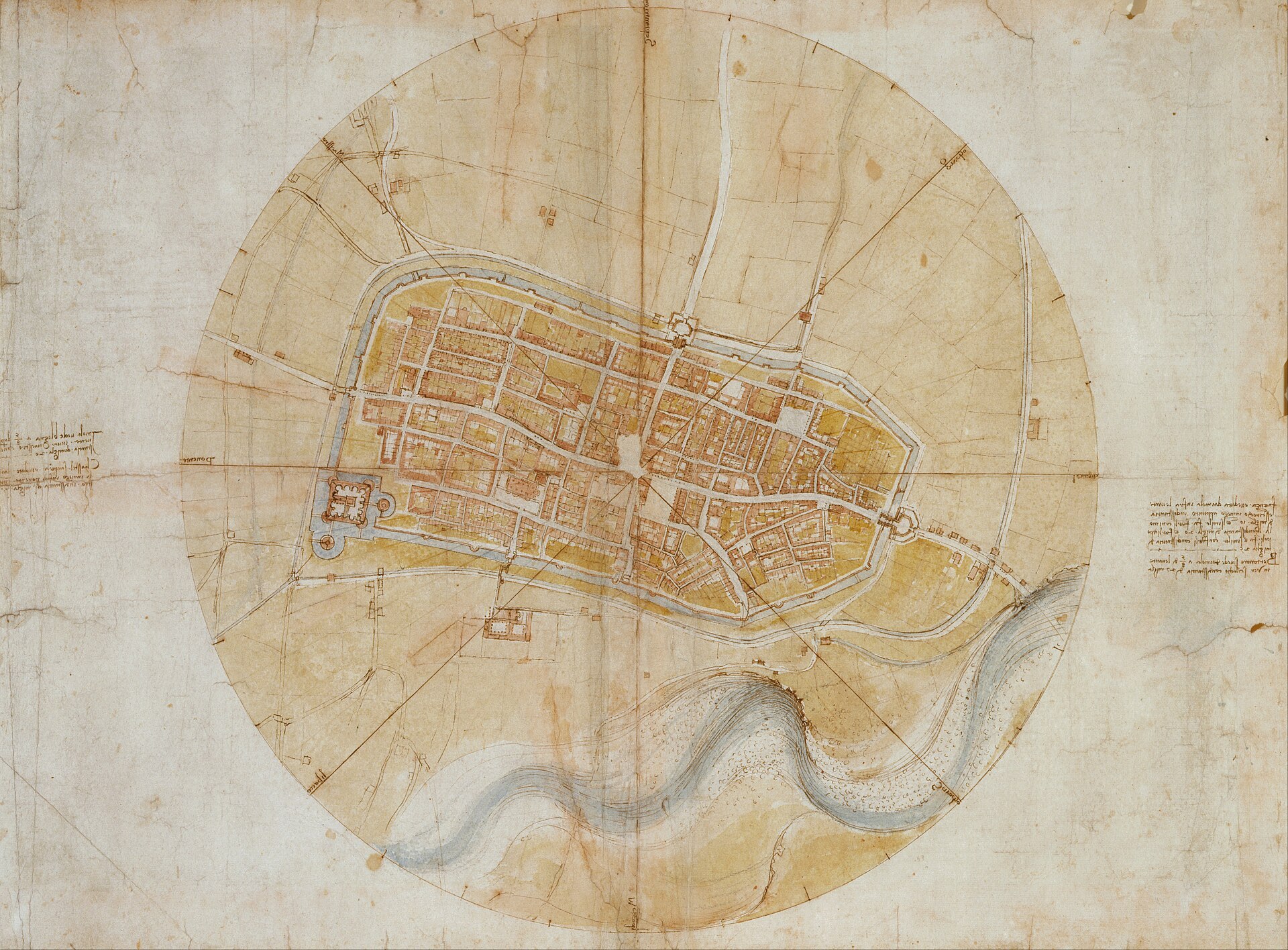
Imola, as regards Bologna, is five points from the West, towards the North West, at a distance of 20 miles.

Castel San Piero is seen from Imola at four points from the West towards the North West, at a distance of 7 miles.

Faenza stands with regard to Imola between East and South East at a distance of ten miles. Forli stands with regard to Faenza between South East and East at a distance of 20 miles from Imola and ten from Faenza.

Forlimpopoli lies in the same direction at 25 miles from Imola.

Bertinoro, as regards Imola, is five points from the East to wards the South East, at 27 miles.

Leonardo, A map of Imola, Royal Collection, RCIN 912284
Leonardo, A map of Imola, Royal Collection, RCIN 912284 Source

L. 88b

§ 1051

Imola as regards Bologna is five points from the West towards the North West at a distance of 20 miles.

Castel San Pietro lies exactly North West of Imola, at a distance of 7 miles.

Faenza, as regards Imola lies exactly half way between the East and South East at a distance of 10 miles; and Forli lies in the same direction from Imola at a distance of 20 miles; and Forlimpopolo lies in the same direction from Forli at a distance of 25 miles.

Bertinoro is seen from Imola two points from the East towards the South East at a distance of 27 miles.

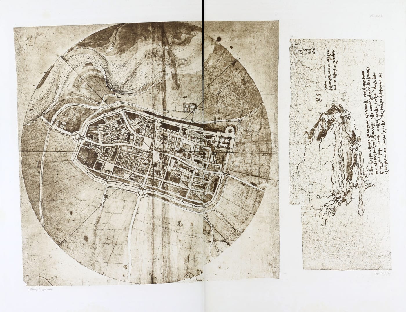
Plate CXI: Two Maps: No. 1 representing the Town of Imola from the Royal Library, Windsor Castle,—see text No. 1051—; No. 2 representing the Mediterranean Sea; from the Codex Atlanticus—see text No. 1092
Plate CXI. Two Maps: No. 1 representing the Town of Imola from the Royal Library, Windsor Castle,—see text No. 1051—; No. 2 representing the Mediterranean Sea; from the Codex Atlanticus—see text No. 1092

W. L. 229a · Pl. CXI, No. 1

§ 1052

>From Bonconventi to Casa Nova are 10 miles, from Casa Nova to Chiusi 9 miles, from Chiusi to Perugia, from, Perugia to Santa Maria degli Angeli, and then to Fuligno.

L. 94b · Pl. CXIII

See Plate CXIII, shown with § 988

§ 1053

On the first of August 1502, the library at Pesaro.

L. o"

§ 1054

Of Painting

On the tops and sides of hills foreshorten the shape of the ground and its divisions, but give its proper shape to what is turned towards you.

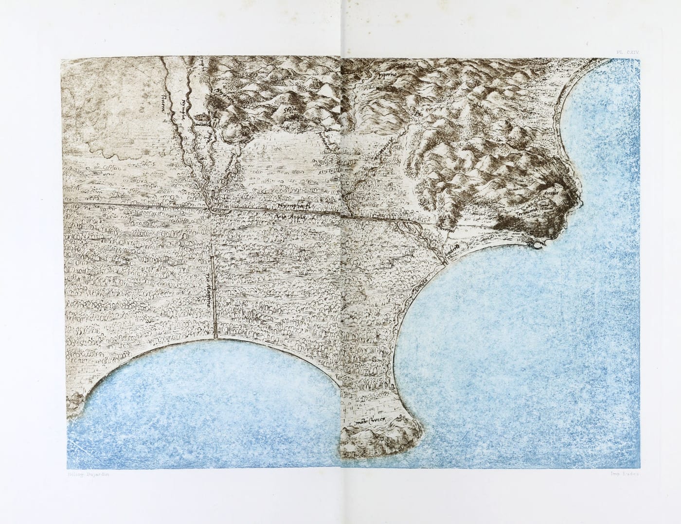
Plate CXIV: Coloured Map of the sea shore between Rome and Naples; from the Royal Library, Windsor Castle
Plate CXIV. Coloured Map of the sea shore between Rome and Naples; from the Royal Library, Windsor Castle

L. 21a · Pl. CXII

See Plate CXII, shown with § 1006

See Plate CXIII, shown with § 988

Alessandria in Piedmont (1055. 1056)

§ 1055

At Candia in Lombardy, near Alessandria della Paglia, in making a well for Messer Gualtieri of Candia, the skeleton of a very large boat was found about 10 braccia underground; and as the timber was black and fine, it seemed good to the said Messer Gualtieri to have the mouth of the well lengthened in such a way as that the ends of the boat should be uncovered.

Leic. 9b

§ 1056

At Alessandria della Paglia in Lombardy there are no stones for making lime of, but such as are mixed up with an infinite variety of things native to the sea, which is now more than 200 miles away.

Leic. 10b

The Alps (1057-1062)

§ 1057

At Monbracco, above Saluzzo,—a mile above the Certosa, at the foot of Monte Viso, there is a quarry of flakey stone, which is as white as Carrara marble, without a spot, and as hard as porphyry or even harder; of which my worthy gossip, Master Benedetto the sculptor, has promised to give me a small slab, for the colours, the second day of January 1511.

Manuscript page cited by Richter for this passage: Leonardo, Paris Manuscript G, f. 1v, Bibliothèque de l'Institut de France
Manuscript page cited by Richter for this passage: Leonardo, Paris Manuscript G, f. 1v, Bibliothèque de l'Institut de France Source

G. 1b

§ 1058

That there are springs which suddenly break forth in earthquakes or other convulsions and suddenly fail; and this happened in a mountain in Savoy where certain forests sank in and left a very deep gap, and about four miles from here the earth opened itself like a gulf in the mountain, and threw out a sudden and immense flood of water which scoured the whole of a little valley of the tilled soil, vineyards and houses, and did the greatest mischief, wherever it overflowed.

Leic. 11b

§ 1059

The river Arve, a quarter of a mile from Geneva in Savoy, where the fair is held on midsummerday in the village of Saint Gervais.

C. A. 86b; 250b

§ 1060

And this may be seen, as I saw it, by any one going up Monbroso , a peak of the Alps which divide France from Italy. The base of this mountain gives birth to the 4 rivers which flow in four different directions through the whole of Europe. And no mountain has its base at so great a height as this, which lifts itself above almost all the clouds; and snow seldom falls there, but only hail in the summer, when the clouds are highest. And this hail lies [unmelted] there, so that if it were not for the absorption of the rising and falling clouds, which does not happen more than twice in an age, an enormous mass of ice would be piled up there by the layers of hail, and in the middle of July I found it very considerable; and I saw the sky above me quite dark, and the sun as it fell on the mountain was far brighter here than in the plains below, because a smaller extent of atmosphere lay between the summit of the mountain and the sun.

Leic. 4a

§ 1061

In the mountains of Verona the red marble is found all mixed with cockle shells turned into stone; some of them have been filled at the mouth with the cement which is the substance of the stone; and in some parts they have remained separate from the mass of the rock which enclosed them, because the outer covering of the shell had interposed and had not allowed them to unite with it; while in other places this cement had petrified those which were old and almost stripped the outer skin.

Leic. 9b

§ 1062

Bridge of Goertz-Wilbach (?).

C. A. 231b; 696a

The Appenins (1063-1068)

§ 1063

That part of the earth which was lightest remained farthest from the centre of the world; and that part of the earth became the lightest over which the greatest quantity of water flowed. And therefore that part became lightest where the greatest number of rivers flow; like the Alps which divide Germany and France from Italy; whence issue the Rhone flowing Southwards, and the Rhine to the North. The Danube or Tanoia towards the North East, and the Po to the East, with innumerable rivers which join them, and which always run turbid with the soil carried by them to the sea.

The shores of the sea are constantly moving towards the middle of the sea and displace it from its original position. The lowest portion of the Mediterranean will be reserved for the bed and current of the Nile, the largest river that flows into that sea. And with it are grouped all its tributaries, which at first fell into the sea; as may be seen with the Po and its tributaries, which first fell into that sea, which between the Appenines and the German Alps was united to the Adriatic sea.

That the Gallic Alps are the highest part of Europe.

Leic. 10a

§ 1064

And of these I found some in the rocks of the high Appenines and mostly at the rock of La Vernia.

Manuscript page cited by Richter for this passage: Leonardo, Paris Manuscript E, f. 1r, Bibliothèque de l'Institut de France
Manuscript page cited by Richter for this passage: Leonardo, Paris Manuscript E, f. 1r, Bibliothèque de l'Institut de France Source

E. 1a

§ 1065

At Parma, at 'La Campana' on the twenty-fifth of October 1514.

Manuscript page cited by Richter for this passage: Leonardo, Paris Manuscript E, f. 80r, Bibliothèque de l'Institut de France
Manuscript page cited by Richter for this passage: Leonardo, Paris Manuscript E, f. 80r, Bibliothèque de l'Institut de France Source

E. 80a

§ 1066

A method for drying the marsh of Piombino.

C. A. 137a; 414a

Compare Plate XXXV, shown with § 348

§ 1067

The shepherds in the Romagna at the foot of the Apennines make peculiar large cavities in the mountains in the form of a horn, and on one side they fasten a horn. This little horn becomes one and the same with the said cavity and thus they produce by blowing into it a very loud noise.

K.1 2a

§ 1068

A spring may be seen to rise in Sicily which at certain times of the year throws out chesnut leaves in quantities; but in Sicily chesnuts do not grow, hence it is evident that that spring must issue from some abyss in Italy and then flow beneath the sea to break forth in Sicily.

Leic. 31b

II. France

§ 1069

Germany. France

a. Austria, a. Picardy. b. Saxony. b. Normandy. c. Nuremberg. c. Dauphine. d. Flanders.

SPAIN.

a. Biscay. b. Castille. c. Galicia. d. Portugal. e. Taragona. f. Granada.

C. A. 353b; 1105b

§ 1070

Perpignan. Roanne. Lyons. Paris. Ghent. Bruges. Holland.

C. A. 358b; 1124b

§ 1071

At Bordeaux in Gascony the sea rises about 40 braccia before its ebb, and the river there is filled with salt water for more than a hundred and fifty miles; and the vessels which are repaired there rest high and dry on a high hill above the sea at low tide.

Leic. 27b

§ 1072

The Rhone issues from the lake of Geneva and flows first to the West and then to the South, with a course of 400 miles and pours its waters into the Mediterranean.

Leic. 34b

§ 1073

c d is the garden at Blois; a b is the conduit of Blois, made in France by Fra Giocondo, b c is what is wanting in the height of that conduit, c d is the height of the garden at Blois, e f is the siphon of the conduit, b c, e f, f g is where the siphon discharges into the river.

K.3 20a

Compare Plate LXXXVIII, shown with § 751

§ 1074

The river Loire at Amboise.

The river is higher within the bank b d than outside that bank.

The island where there is a part of Amboise.

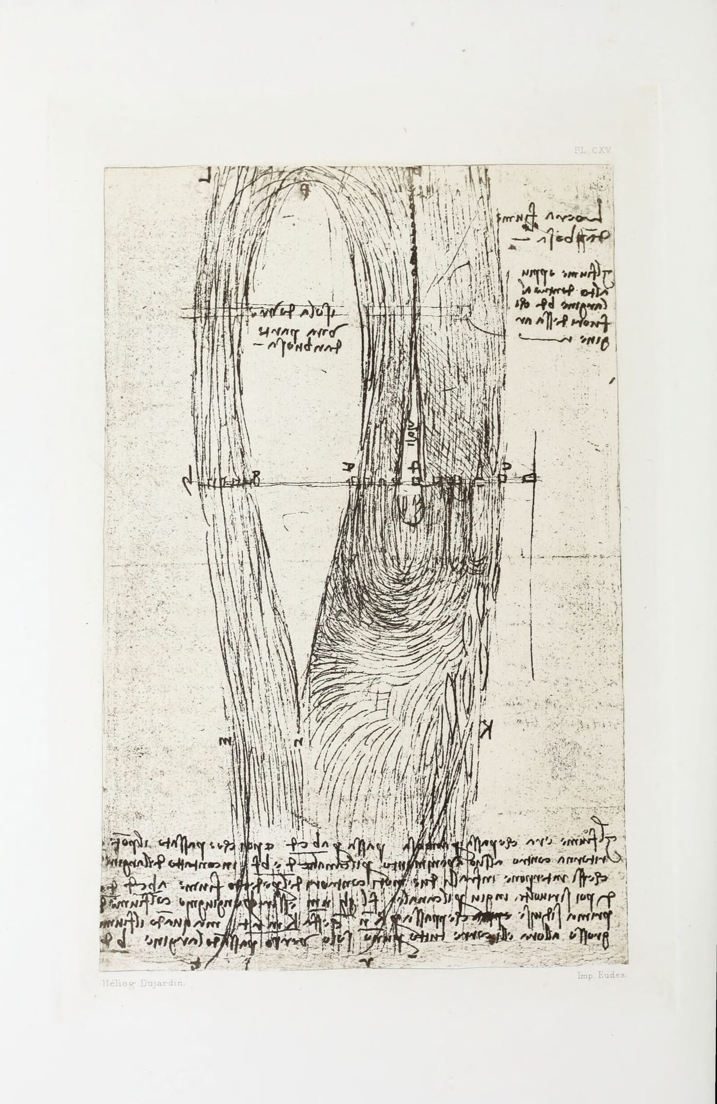
This is the river that passes through Amboise; it passes at a b c d, and when it has passed the bridge it turns back, against the original current, by the channel d e, b f in contact with the bank which lies between the two contrary currents of the said river, a b, c d, and d e, b f. It then turns down again by the channel f l, g h, n m, and reunites with the river from which it was at first separated, which passes by k n, which makes k m, r t. But when the river is very full it flows all in one channel passing over the bank b d.

Plate CXV: Sketch Map of the Loire at Amboise; from the Arundel Manuscript, British Museum—see text No. 1074
Plate CXV. Sketch Map of the Loire at Amboise; from the Arundel Manuscript, British Museum—see text No. 1074

Br. M. 269a · Pl. CXV

§ 1075

The water may be dammed up above the level of Romorantin to such a height, that in its fall it may be used for numerous mills.

The river at Villefranche may be conducted to Romorantin which may be done by the inhabitants; and the timber of which their houses are built may be carried in boats to Romorantin. The river may be dammed up at such a height that the waters may be brought back to Romorantin with a convenient fall.

Br. M. 270b

§ 1076

As to whether it is better that the water should all be raised in a single turn or in two?

The answer is that in one single turn the wheel could not support all the water that it can raise in two turns, because at the half turn of the wheel it would be raising 100 pounds and no more; and if it had to raise the whole, 200 pounds in one turn, it could not raise them unless the wheel were of double the diameter and if the diameter were doubled, the time of its revolution would be doubled; therefore it is better and a greater advantage in expense to make such a wheel of half the size (?) &c.

The going down of the nave of the wheel must not be so low as to touch the surface of the water, because by touching the water its momentum will be lessened.

And if on the contrary the conduit for the water were ten times the size of the pipe for the water escaping from it, and if it had ten times less motion, what would be its office? This is answered by the 9th of this which says that the water would rise in the pipe whence it first flow, to a tenth part of its original height.

Br. M. 269b

§ 1077

If the river m n, an affluant of the river Loire, were turned with its muddy waters, into the river [of Romorantin, this would fatten the land which it would water and would render the country fertile to supply food to the inhabitants, and would make navigable canals for mercantile purposes.

The way in which the river in its flow should scour its own channel.

By the ninth of the third; the more rapid it is, the more it wears away its channel; and, by the converse proposition, the slower the water the more it deposits that which renders it turbid.

And let the sluice be movable like the one I arranged in Friuli , where when one sluice was opened the water which passed through it dug out the bottom. Therefore when the rivers are flooded, the sluices of the mills ought to be opened in order that the whole course of the river may pass through falls to each mill; there should be many in order to give a greater impetus, and so all the river will be scoured. And below the site of each of the two mills there may be one of the said sluice falls; one of them may be placed below each mill.

Br. M. 270b

§ 1078

A trabocco is four braccia, and one mile is three thousand of the said braccia. Each braccio is divided into 12 inches; and the water in the canals has a fall in every hundred trabocchi of two of these inches; therefore 14 inches of fall are necessary in two thousand eight hundred braccia of flow in these canals; it follows that 15 inches of fall give the required momentum to the currents of the waters in the said canals, that is one braccio and a half in the mile. And from this it may be concluded that the water taken from the river of Ville-franche and lent to the river of Romorantin will..... Where one river by reason of its low level cannot flow into the other, it will be necessary to dam it up, so that it may acquire a fall into the other, which was previously the higher.

The eve of Saint Antony I returned from Romorantin to Amboise, and the King went away two days before from Romorantin.

>From Romorantin as far as the bridge at Saudre it is called the Saudre, and from that bridge as far as Tours it is called the Cher.

I would test the level of that channel which is to lead from the Loire to Romorantin, with a channel one braccio wide and one braccio deep.

C. A. 329b; 993a · Pl. XXII

§ 1079

The Road to Orleans

At 1/4 from the South to the South East. At 1/3 from the South to the South East. At 1/4 from the South to the South East. At 1/5 from the South to the South East. Between the South West and South, to the East bearing to the South; from the South towards the East 1/8; thence to the West, between the South and South West; at the South.

Br. M. 263b

On the Germans (1080. 1081)

§ 1080

The way in which the Germans closing up together cross and interweave their broad leather shields against the enemy, stooping down and putting one of the ends on the ground while they hold the rest in their hand.

B. 61a

§ 1081

The Germans are wont to annoy a garrison with the smoke of feathers, sulphur and realgar, and they make this smoke last 7 or 8 hours. Likewise the husks of wheat make a great and lasting smoke; and also dry dung; but this must be mixed with olive husks, that is olives pressed for oil and from which the oil has been extracted.

B. 63b

The Danube

§ 1082

That the valleys were formerly in great part covered by lakes the soil of which always forms the banks of rivers,—and by seas, which afterwards, by the persistent wearing of the rivers, cut through the mountains and the wandering courses of the rivers carried away the other plains enclosed by the mountains; and the cutting away of the mountains is evident from the strata in the rocks, which correspond in their sections as made by the courses of the rivers, The Haemus mountains which go along Thrace and Dardania and join the Sardonius mountains which, going on to the westward change their name from Sardus to Rebi, as they come near Dalmatia; then turning to the West cross Illyria, now called Sclavonia, changing the name of Rebi to Albanus, and going on still to the West, they change to Mount Ocra in the North; and to the South above Istria they are named Caruancas; and to the West above Italy they join the Adula, where the Danube rises , which stretches to the East and has a course of 1500 miles; its shortest line is about l000 miles, and the same or about the same is that branch of the Adula mountains changed as to their name, as before mentioned. To the North are the Carpathians, closing in the breadth of the valley of the Danube, which, as I have said extends eastward, a length of about 1000 miles, and is sometimes 200 and in some places 300 miles wide; and in the midst flows the Danube, the principal river of Europe as to size. The said Danube runs through the middle of Austria and Albania and northwards through Bavaria, Poland, Hungary, Wallachia and Bosnia and then the Danube or Donau flows into the Black Sea, which formerly extended almost to Austria and occupied the plains through which the Danube now courses; and the evidence of this is in the oysters and cockle shells and scollops and bones of great fishes which are still to be found in many places on the sides of those mountains; and this sea was formed by the filling up of the spurs of the Adula mountains which then extended to the East joining the spurs of the Taurus which extend to the West. And near Bithynia the waters of this Black Sea poured into the Propontis [Marmora] falling into the Aegean Sea, that is the Mediterranean, where, after a long course, the spurs of the Adula mountains became separated from those of the Taurus. The Black Sea sank lower and laid bare the valley of the Danube with the above named countries, and the whole of Asia Minor beyond the Taurus range to the North, and the plains from mount Caucasus to the Black Sea to the West, and the plains of the Don this side—that is to say, at the foot of the Ural mountains. And thus the Black Sea must have sunk about 1000 braccia to uncover such vast plains.

Leic. 1b

III. The Countries of the Western End of the Mediterranean

The straits of Gibraltar (1083-1085)

§ 1083

Why the Sea Makes a Stronger Current in the Straits of Spain Than Elsewhere

A river of equal depth runs with greater speed in a narrow space than in a wide one, in proportion to the difference between the wider and the narrower one.

This proposition is clearly proved by reason confirmed by experiment. Supposing that through a channel one mile wide there flows one mile in length of water; where the river is five miles wide each of the 5 square miles will require 1/5 of itself to be equal to the square mile of water required in the sea, and where the river is 3 miles wide each of these square miles will require the third of its volume to make up the amount of the square mile of the narrow part; as is demonstrated in f g h at the mile marked n.

Manuscript page cited by Richter for this passage: Leonardo, Paris Manuscript A, f. 57r, Bibliothèque de l'Institut de France
Manuscript page cited by Richter for this passage: Leonardo, Paris Manuscript A, f. 57r, Bibliothèque de l'Institut de France Source

A. 57a

§ 1084

Why the Current of Gibraltar Is Always Greater to the West Than to the East

The reason is that if you put together the mouths of the rivers which discharge into the Mediterranean sea, you would find the sum of water to be larger than that which this sea pours through the straits into the ocean. You see Africa discharging its rivers that run northwards into this sea, and among them the Nile which runs through 3000 miles of Africa; there is also the Bagrada river and the Schelif and others. Likewise Europe pours into it the Don and the Danube, the Po, the Rhone, the Arno, and the Tiber, so that evidently these rivers, with an infinite number of others of less fame, make its great breadth and depth and current; and the sea is not wider than 18 miles at the most westerly point of land where it divides Europe from Africa.

C. A. 212b; 626b

§ 1085

The gulf of the Mediterranean, as an inland sea, received the principal waters of Africa, Asia and Europe that flowed towards it; and its waters came up to the foot of the mountains that surrounded it and made its shores. And the summits of the Apennines stood up out of this sea like islands, surrounded by salt water. Africa again, behind its Atlas mountains did not expose uncovered to the sky the surface of its vast plains about 3000 miles in length, and Memphis was on the shores of this sea, and above the plains of Italy, where now birds fly in flocks, fish were wont to wander in large shoals.

Leic. 10b

Tunis

§ 1086

The greatest ebb made anywhere by the Mediterranean is above Tunis, being about two and a half braccia and at Venice it falls two braccia. In all the rest of the Mediterranean sea the fall is little or none.

Leic. 27b

Libya

§ 1087

Describe the mountains of shifting deserts; that is to say the formation of waves of sand borne by the wind, and of its mountains and hills, such as occur in Libya. Examples may be seen on the wide sands of the Po and the Ticino, and other large rivers.

F. 61a

Majorca

§ 1088

Circumfulgore is a naval machine. It was an invention of the men of Majorca.

B. 82b

The Tyrrhene Sea

§ 1089

Some at the Tyrrhene sea employ this method; that is to say they fastened an anchor to one end of the yard, and to the other a cord, of which the lower end was fastened to an anchor; and in battle they flung this anchor on to the oars of the opponent's boat and by the use of a capstan drew it to the side; and threw soft soap and tow, daubed with pitch and set ablaze, on to that side where the anchor hung; so that in order to escape that fire, the defenders of that ship had to fly to the opposite side; and in doing this they aided to the attack, because the galley was more easily drawn to the side by reason of the counterpoise.

Ash. II. 12a

IV. The Levant

The Levantine Sea

§ 1090

On the shores of the Mediterranean 300 rivers flow, and 40, 200 ports. And this sea is 3000 miles long. Many times has the increase of its waters, heaped up by their backward flow and the blowing of the West winds, caused the overflow of the Nile and of the rivers which flow out through the Black Sea, and have so much raised the seas that they have spread with vast floods over many countries. And these floods take place at the time when the sun melts the snows on the high mountains of Ethiopia that rise up into the cold regions of the air; and in the same way the approach of the sun acts on the mountains of Sarmatia in Asia and on those in Europe; so that the gathering together of these three things are, and always have been, the cause of tremendous floods: that is, the return flow of the sea with the West wind and the melting of the snows. So every river will overflow in Syria, in Samaria, in Judea between Sinai and the Lebanon, and in the rest of Syria between the Lebanon and the Taurus mountains, and in Cilicia, in the Armenian mountains, and in Pamphilia and in Lycia within the hills, and in Egypt as far as the Atlas mountains. The gulf of Persia which was formerly a vast lake of the Tigris and discharged into the Indian Sea, has now worn away the mountains which formed its banks and laid them even with the level of the Indian ocean. And if the Mediterranean had continued its flow through the gulf of Arabia, it would have done the same, that is to say, would have reduced the level of the Mediterranean to that of the Indian Sea.

Leic. 31a

The Red Sea. (1091. 1092)

§ 1091

For a long time the water of the Mediterranean flowed out through the Red Sea, which is 100 miles wide and 1500 long, and full of reefs; and it has worn away the sides of Mount Sinai, a fact which testifies, not to an inundation from the Indian sea beating on these coasts, but to a deluge of water which carried with it all the rivers which abound round the Mediterranean, and besides this there is the reflux of the sea; and then, a cutting being made to the West 3000 miles away from this place, Gibraltar was separated from Ceuta, which had been joined to it. And this passage was cut very low down, in the plains between Gibraltar and the ocean at the foot of the mountain, in the low part, aided by the hollowing out of some valleys made by certain rivers, which might have flowed here. Hercules came to open the sea to the westward and then the sea waters began to pour into the Western Ocean; and in consequence of this great fall, the Red Sea remained the higher; whence the water, abandoning its course here, ever after poured away through the Straits of Spain.

Leic. 31a

§ 1092

The surface of the Red Sea is on a level with the ocean.

A mountain may have fallen and closed the mouth of the Red Sea and prevented the outlet of the Mediterranean, and the Mediterranean Sea thus overfilled had for outlet the passage below the mountains of Gades; for, in our own times a similar thing has been seen; a mountain fell seven miles across a valley and closed it up and made a lake. And thus most lakes have been made by mountains, as the lake of Garda, the lakes of Como and Lugano, and the Lago Maggiore. The Mediterranean fell but little on the confines of Syria, in consequence of the Gaditanean passage, but a great deal in this passage, because before this cutting was made the Mediterranean sea flowed to the South East, and then the fall had to be made by its run through the Straits of Gades.

At a the water of the Mediterranean fell into the ocean.

All the plains which lie between the sea and mountains were formerly covered with salt water.

Every valley has been made by its own river; and the proportion between valleys is the same as that between river and river.

The greatest river in our world is the Mediterranean river, which moves from the sources of the Nile to the Western ocean.

And its greatest height is in Outer Mauritania and it has a course of ten thousand miles before it reunites with its ocean, the father of the waters.

That is 3000 miles for the Mediterranean, 3000 for the Nile, as far as discovered and 3000 for the Nile which flows to the East, &c.

C. A. 321b; 971a · Pl. CXI

See Plate CXI, shown with § 1051

The Nile (1093-1098)

§ 1093

Therefore we must conclude those mountains to be of the greatest height, above which the clouds falling in snow give rise to the Nile.

C. A. 94b; 276a

§ 1094

The Egyptians, the Ethiopians, and the Arabs, in crossing the Nile with camels, are accustomed to attach two bags on the sides of the camel's bodies that is skins in the form shown underneath.

In these four meshes of the net the camels for baggage place their feet.

B. 61b

§ 1095

The Tigris passes through Asia Minor and brings with it the water of three lakes, one after the other of various elevations; the first being Munace and the middle Pallas and the lowest Triton. And the Nile again springs from three very high lakes in Ethiopia, and runs northwards towards the sea of Egypt with a course of 4000 miles, and by the shortest and straightest line it is 3000 miles. It is said that it issues from the Mountains of the Moon, and has various unknown sources. The said lakes are about 4000 braccia above the surface of the sphere of water, that is 1 mile and 1/3, giving to the Nile a fall of 1 braccia in every mile.

Leic. 34b

§ 1096

Very many times the Nile and other very large rivers have poured out their whole element of water and restored it to the sea.

Leic. 21b

§ 1097

Why does the inundation of the Nile occur in the summer, coming from torrid countries?

Leic. 22a

§ 1098

It is not denied that the Nile is constantly muddy in entering the Egyptian sea and that its turbidity is caused by soil that this river is continually bringing from the places it passes; which soil never returns in the sea which receives it, unless it throws it on its shores. You see the sandy desert beyond Mount Atlas where formerly it was covered with salt water.

Leic. 32b

Customs of Asiatic Nations (1099. 1100)

§ 1099

The Assyrians and the people of Euboea accustom their horses to carry sacks which they can at pleasure fill with air, and which in case of need they carry instead of the girth of the saddle above and at the side, and they are well covered with plates of cuir bouilli, in order that they may not be perforated by flights of arrows. Thus they have not on their minds their security in flight, when the victory is uncertain; a horse thus equipped enables four or five men to cross over at need.

B. 61b

§ 1100

Small Boats

The small boats used by the Assyrians were made of thin laths of willow plaited over rods also of willow, and bent into the form of a boat. They were daubed with fine mud soaked with oil or with turpentine, and reduced to a kind of mud which resisted the water and because pine would split; and always remained fresh; and they covered this sort of boats with the skins of oxen in safely crossing the river Sicuris of Spain, as is reported by Lucant;

The Spaniards, the Scythians and the Arabs, when they want to make a bridge in haste, fix hurdlework made of willows on bags of ox-hide, and so cross in safety.

B. 62b

Rhodes (1101. 1102)

§ 1101

In [fourteen hundred and] eighty nine there was an earthquake in the sea of Atalia near Rhodes, which opened the sea—that is its bottom—and into this opening such a torrent of water poured that for more than three hours the bottom of the sea was uncovered by reason of the water which was lost in it, and then it closed to the former level.

Leic. 10b

§ 1102

Rhodes has in it 5000 houses.

L. o'

Cyprus (1103. 1104)

§ 1103

Site for [a Temple of] Venus

You must make steps on four sides, by which to mount to a meadow formed by nature at the top of a rock which may be hollowed out and supported in front by pilasters and open underneath in a large portico, in which the water may fall into various vases of granite, porphyry and serpentine, within semi-circular recesses; and the water may overflow from these. And round this portico towards the North there should be a lake with a little island in the midst of which should be a thick and shady wood; the waters at the top of the pilasters should pour into vases at their base, from whence they should flow in little channels.

Starting from the shore of Cilicia towards the South you discover the beauties of the island of Cyprus.

Plate LXXXIII: Drawing of Plans for a Castle, and of a Nude Figure, washed with Indian ink; from the Royal Library, Windsor Castle—see text No. 1103
Plate LXXXIII. Drawing of Plans for a Castle, and of a Nude Figure, washed with Indian ink; from the Royal Library, Windsor Castle—see text No. 1103

W. XVIIa · Pl. LXXXIII

The Caspian Sea (1105. 1106)

§ 1104

>From the shore of the Southern coast of Cilicia may be seen to the South the beautiful island of Cyprus, which was the realm of the goddess Venus, and many navigators being attracted by her beauty, had their ships and rigging broken amidst the reefs, surrounded by the whirling waters. Here the beauty of delightful hills tempts wandering mariners to refresh themselves amidst their flowery verdure, where the winds are tempered and fill the island and the surrounding seas with fragrant odours. Ah! how many a ship has here been sunk. Ah! how many a vessel broken on these rocks. Here might be seen barks without number, some wrecked and half covered by the sand; others showing the poop and another the prow, here a keel and there the ribs; and it seems like a day of judgment when there should be a resurrection of dead ships, so great is the number of them covering all the Northern shore; and while the North gale makes various and fearful noises there.

W. XVIIb

§ 1105

Write to Bartolomeo the Turk as to the flow and ebb of the Black sea, and whether he is aware if there be such a flow and ebb in the Hyrcanean or Caspian sea.

C. A. 256a; 773a

§ 1106

Why Water Is Found at the Top of Mountains

>From the straits of Gibraltar to the Don is 3500 miles, that is one mile and 1/6, giving a fall of one braccio in a mile to any water that moves gently. The Caspian sea is a great deal higher; and none of the mountains of Europe rise a mile above the surface of our seas; therefore it might be said that the water which is on the summits of our mountains might come from the height of those seas, and of the rivers which flow into them, and which are still higher.

F. 50a

The sea of Azov

§ 1107

Hence it follows that the sea of Azov is the highest part of the Mediterranean sea, being at a distance of 3500 miles from the Straits of Gibraltar, as is shown by the map for navigation; and it has 3500 braccia of descent, that is, one mile and 1/6; therefore it is higher than any mountains which exist in the West.

F. 68a

The Dardanelles

§ 1108

In the Bosphorus the Black Sea flows always into the Egean sea, and the Egean sea never flows into it. And this is because the Caspian, which is 400 miles to the East, with the rivers which pour into it, always flows through subterranean caves into this sea of Pontus; and the Don does the same as well as the Danube, so that the waters of Pontus are always higher than those of the Egean; for the higher always fall towards the lower, and never the lower towards the higher.

Leic. 31b

Constantinople

§ 1109

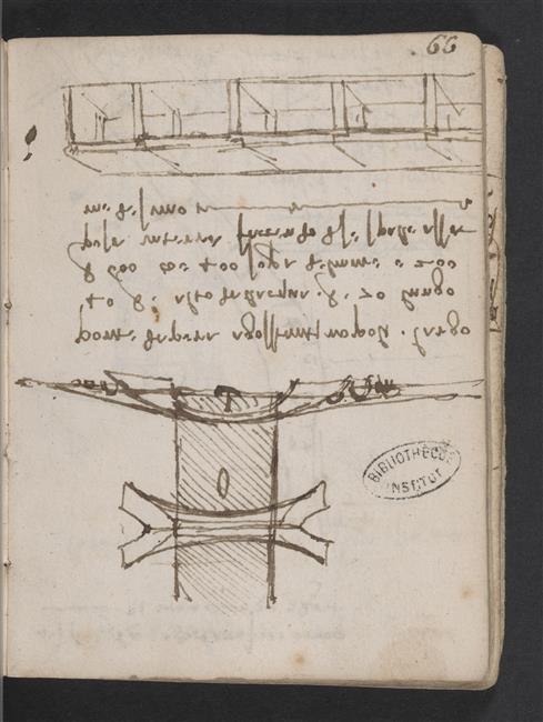
The bridge of Pera at Constantinople, 40 braccia wide, 70 braccia high above the water, 600 braccia long; that is 400 over the sea and 200 on the land, thus making its own abutments.

Manuscript page cited by Richter for this passage: Leonardo, Paris Manuscript L, f. 66r, Bibliothèque de l'Institut de France
Manuscript page cited by Richter for this passage: Leonardo, Paris Manuscript L, f. 66r, Bibliothèque de l'Institut de France Source

L. 66a · Pl. CX, No. 1

See Plate CX, shown with § 765

The Euphrates

§ 1110

If the river will turn to the rift farther on it will never return to its bed, as the Euphrates does, and this may do at Bologna the one who is disappointed for his rivers.

Leic. 28a

Centrae Asia

§ 1111

Mounts Caucasus, Comedorum, and Paropemisidae are joined together between Bactria and India, and give birth to the river Oxus which takes its rise in these mountains and flows 500 miles towards the North and as many towards the West, and discharges its waters into the Caspian sea; and is accompanied by the Oxus, Dargados, Arthamis, Xariaspes, Dargamaim, Ocus and Margus, all very large rivers. From the opposite side towards the South rises the great river Indus which sends its waters for 600 miles Southwards and receives as tributaries in this course the rivers Xaradrus, Hyphasis, Vadris, Vandabal Bislaspus to the East, Suastes and Coe to the West, uniting with these rivers, and with their waters it flows 800 miles to the West; then, turning back by the Arbiti mountains makes an elbow and turns Southwards, where after a course of about 100 miles it finds the Indian Sea, in which it pours itself by seven branches. On the side of the same mountains rises the great Ganges, which river flows Southwards for 500 miles and to the Southwest a thousand ... and Sarabas, Diarnuna, Soas and Scilo, Condranunda are its tributaries. It flows into the Indian sea by many mouths.

C. A. 94b; 276a

On the natives of hot countries

§ 1112

Men born in hot countries love the night because it refreshes them and have a horror of light because it burns them; and therefore they are of the colour of night, that is black. And in cold countries it is just the contrary.

C. A. 384b; 1189b · MS. H3 55b